
Readings and Visual Media
Exploiting a Land of Plenty
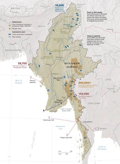
This map of Burma features the location of important resources which are sold to foreign countries to generate income, as well as areas where the population has been displaced to make room for these projects – and reduce resistance to them, as well.
Satellite Image of Mainland Southeast Asia
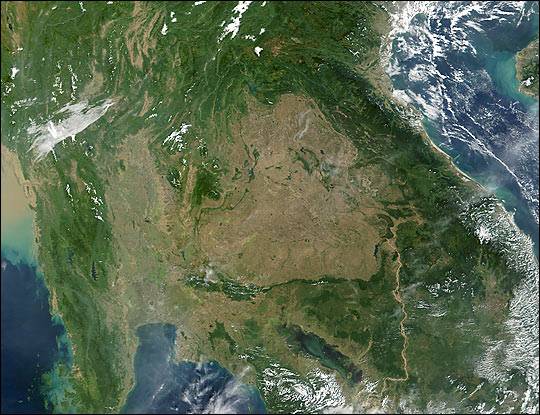
Image of Southeast Asia taken in 2001 by NASA’s Terra spacecraft shows the jungles of Vietnam, Laos, and Cambodia and the Mekong River.
Ring of Fire
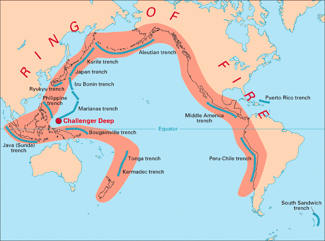
Volcanic arcs and oceanic trenches partly encircling the Pacific Basin form the so-called Ring of Fire, a zone of frequent earthquakes and volcanic eruptions. The trenches are shown in blue-green. The volcanic island arcs, although not labelled, are parallel to, and always landward of, the trenches. For example, the island arc associated with the Aleutian Trench is represented by the long chain of volcanoes that make up the Aleutian Islands.
Ring of Fire - Active Volcanoes and Plate Tectonics
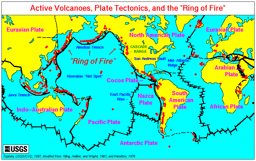
This map is produced by the U.S. Geological Survey's Cascades Volcano Observatory.
Seismicity of the Earth 1900 – 2010
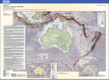
This USGS publication focuses upon the Australia plate and vicinity. It includes a large portion of Indonesia. The map shows great detail of the different types of plate boundaries found in this region, as well as seismic events for a 110 year time period. A PDF of the map can be downloaded from the site.
Understanding Plate Motions
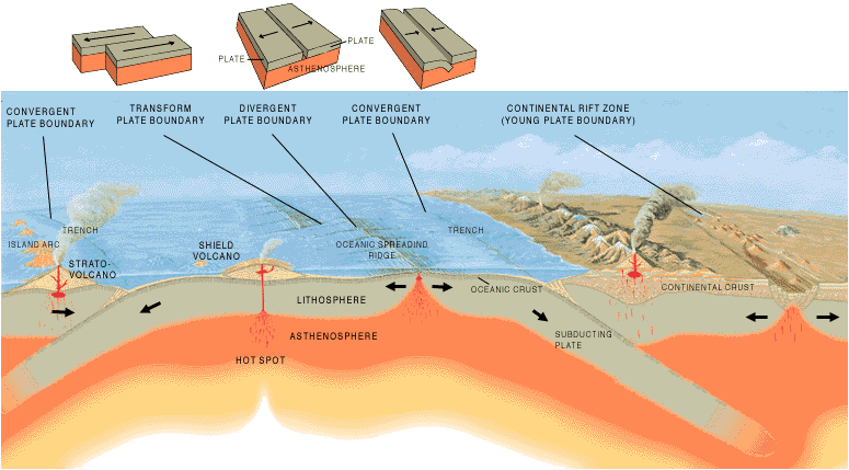
Artist's cross section illustrating the main types of plate boundaries (see text); East African Rift Zone is a good example of a continental rift zone. (Cross section by José F. Vigil from This Dynamic Planet -- a wall map produced jointly by the U.S. Geological Survey, the Smithsonian Institution, and the U.S. Naval Research Laboratory.)
Dynamic Earth Interactive: Plates and Boundaries
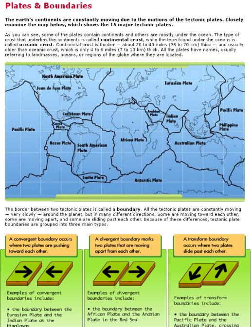
An interactive annotated plate boundary map, that includes types of boundaries along each plate as well as a simplistic representation of plate movements.
Dynamic Earth Interactive: Slip, Slide & Collide
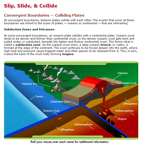
An animated illustration of plate boundaries.
Myanmar’s River of Spirits
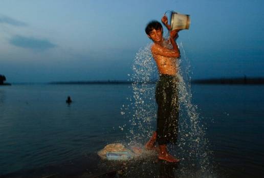
This collection of materials focuses upon the Irrawaddy River in Burma/Myanmar. It contains an article printed in the magazine in May 2006, a photo gallery of images from the article, a short video of a spirit festival and a list of resources for more information on the river and Burma.
http://ngm.nationalgeographic.com/2006/05/irrawaddy-river/salak-text
Perry-Castaneda Library Map Collection: Asia Maps
An extensive collection of maps from the University of Texas at Austin that includes historical, thematic, topographic, and general reference maps from all over Asia.